Monday, July 03, 2006
And Get On With It

"If the world is upside down the way it is now, wouldn't we have to turn it over to get it to stand up straight?" - Eduardo Galeano
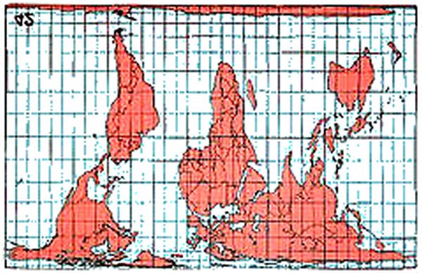
There is another map called 'Peter's Projection' which shows the Earth with its actual land areas - very interesting, gives a completely different perspective on world politics.
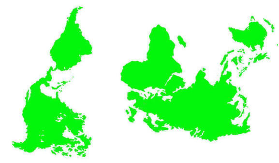
Thanks to Pisces for informing us that Peter’s World Map is only one that represents countries, continents, and seas accurately according to their surface areas. Here it is (inverted) for comparison. We have been duped into believing false facts about the Earth and for self serving political reason. Traditional Mercator maps show countries incorrectly in proportion or relative size to one another, to the advantage of the European colonial powers who drew the maps as they dominated and exploited the world, while the southern continents (Africa, South America, Australia) are shown far too small. Observe these 4 blatant fallacies:
1)- Traditionally, Europe, with its 9.7 million sq kms appears to be larger than South America which is 17.8 sq kms. But in fact, South America is nearly twice the size of Europe!
2)- Traditionally, North America, having 19 million sq kms, appears to be considerably larger than Africa which has 30 million sq kms. The fact is that Africa is really the largest continent in the world and its true dimensions have been fudged by colonial England to play it down.
3)- Traditionally, Scandinavia, having 1.1 million sq kms, appears to be as large as India which has 3.3 sq kms. In fact, India is three times the size of Scandinavia, and its true form is very elongated.
4)- Traditionally, Greenland, having 2.1 million sq kms appears larger than China when in fact China with 9.5 million sq kms is more than four times larger!
And, then we have the USA Dumbdowner Projection. The view presented here is its normal Far Right side up to more easily read the labels and better grasp the profound mental depth behind its construction.
Ok to laugh or cry how about i do both .o where o where is the total truth oh man what is the plan????
“I am astonished each time I come to the U.S. by the ignorance of a high percentage of the population, which knows almost nothing about Latin America or about the world. It's quite blind and deaf to anything that may happen outside the frontiers of the U.S.”
Another quote by Eduardo Galeano
All America seems to see on a map is their own country and the rest a big back yard for its use.
i read this and my heart broke.
"All America seems to see on a map is their own country and the rest a big back yard for its use. "
American is the whole place the U>S>A> is the fenced off country .America is the whole land or was called turtle island to many but seams no mater what .WE are all judged by the eleat and the rich and the people who just want a simple life and not a wroldly life o well .Kepp it of mark it off how i feel
Looks like I was born in Dragon Country - I just love that US Dumbdowner Projection - I think I just wet myself laughing.
Just think i was born in the year of the wood Dragon .Dont change i was born in the USA on the land mass called america but then im dumb i think the whole thing is america not just the fenced in part.
"Peter’s World Map is only one that represents countries, continents, and seas accurately according to their surface areas"
Unfortunately that is not true. Equal area maps have been around for centuries. The Peters Projection itself is identical to the Gall Orthographic Projection of 1855,. That in turn was a modification of an equal area projection created in 1772.
The Peters Map is a good counter to the Mercator as it does get land mass areas more or less right but this is at the expense of shape.
The problem with any map is that it tries to render a sphere onto a cylinder. There is not a world map in existence that can do this without some distortion of size, shape or distance.
The bottom line is that if you want to see what the world looks like, get a globe.

